Undraining the Swamp
Credit to Author: Ankita Rao| Date: Sat, 04 Nov 2017 15:00:00 +0000
This story is part of OUTER LIMITS, a Motherboard series about people, technology, and going outside. Let us be your guide.
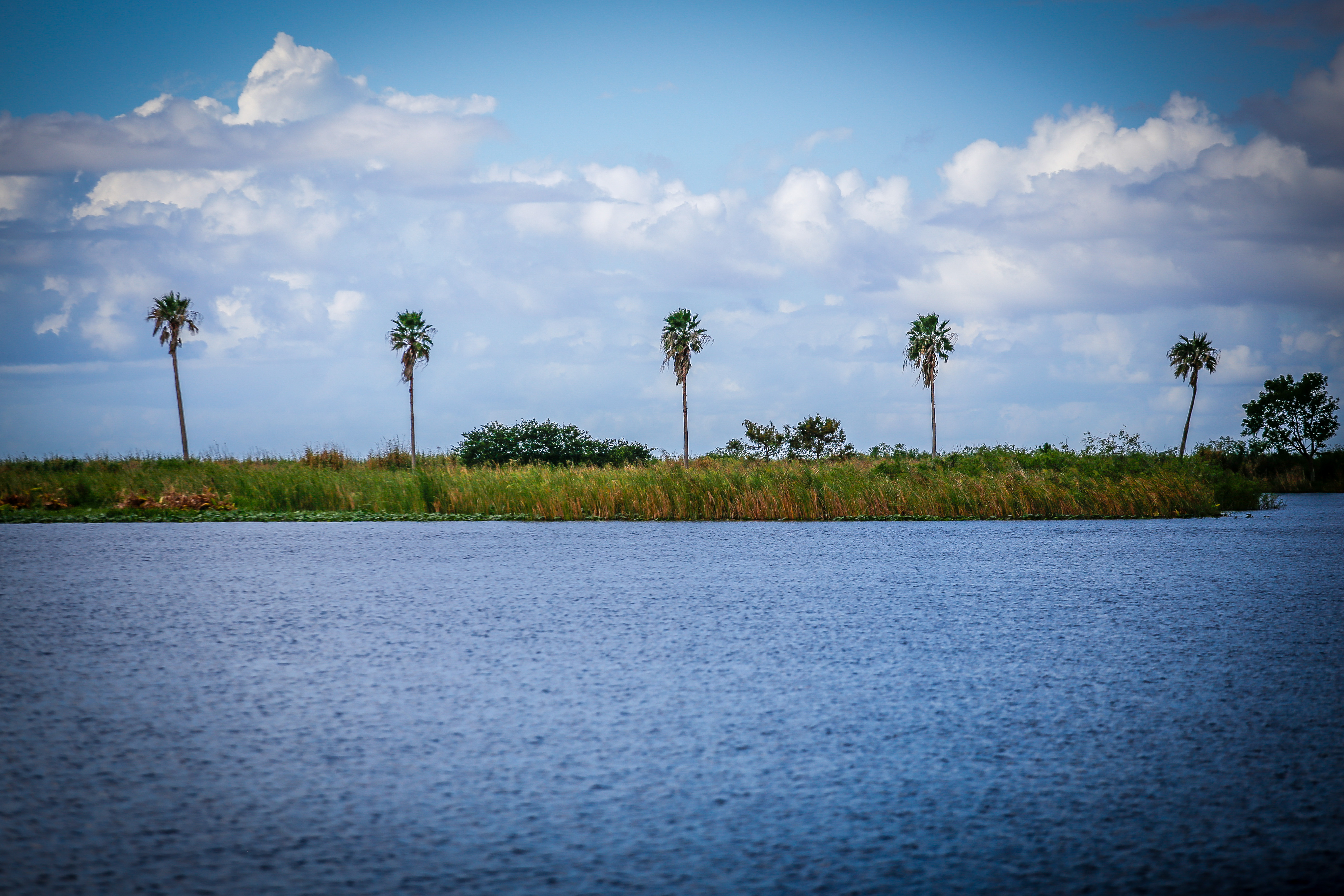
From some vantage points Lake Okeechobee, all 730 square miles of it, looks like an ocean. The third largest natural freshwater lake in the country irrigates farmland and sustains wildlife across six counties in south Florida. People boat and fish, bringing fresh catch home for dinner.
But for the 13,000 residents of Glades County, the lake can loom large and menacing, bursting against aging levees and control gates managed by the US Army Corps of Engineers. The specter of the 1926 and 1928 hurricanes, both of which burst the dike open and together killed thousands of people, still hangs over communities here. People go about their lives fearing they’re one storm away from another devastating breach, as was the case during Hurricane Irma in August.
“The more rainwater that increases in Lake Okeechobee, the more pressure is on the lake, and that pressure can continue to build up and build up and build up and one day the levee can go,” said Tammy Jackson-Moore, a Belle Glade resident who co-founded Guardians of the Glades, a nonprofit focused on community advocacy. “And we’re talking about wiping out entire communities here.”
Florida is defined by its water—the water flowing around it, through it, increasingly over it. But throughout the twentieth century, its major arteries of fresh water, which flowed from the Kissimmee River south of Orlando to Lake Okeechobee and down to the swampy Everglades, were permanently rerouted by the federal government and landowners to stop flooding, and make room for agriculture and housing in the southern part of the state.
Draining the water flow has allowed for bursts of economic growth. Today, Florida’s agriculture industry, some of which sits on former swamp land, is worth $104 billion and employs two million people, and a big part of that is the politically influential sugar industry. But tampering with nature has its consequences. The Everglades, the largest swath of subtropical wilderness in the country, is now half of its size circa 1920, and the ecosystem has deteriorated, losing wildlife and native flora. Without a natural place to flow, stagnant water pushes toxic algae blooms into the rivers, and turns pristine ocean into sludgy waste.
Jackson-Moore.
Now the state is working with the Army Corps of Engineers—the government agency partly responsible for rerouting and draining water to begin with—and the South Florida Water Management District to attempt the largest hydraulic restoration project in the world. And while some say the effort has turned Florida into a battleground, pitting sugar farmers against legislators and environmentalists, others are hoping this will finally right certain man-made wrongs and restore some balance to the state.
If the government is able to fully fund the plan, and should dozens of contractors and state forces successfully carry it out, it could permanently change Florida. And set a precedent for inevitable restoration projects around the world, which are becoming increasingly crucial as climate change manifests in stronger storms and sea level rise.
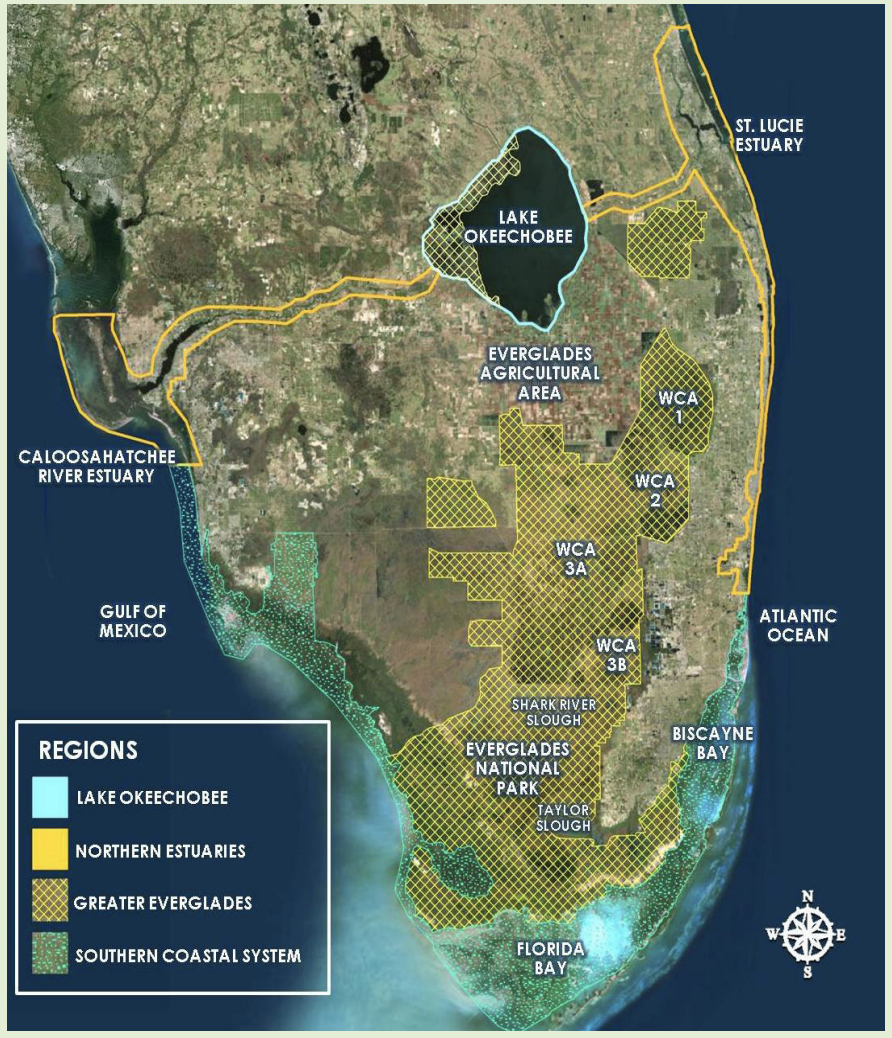
I followed the historic flow, from Lake Okeechobee down to the Everglades National Park, to find out how these government promises are playing out.
*
THE PLAN
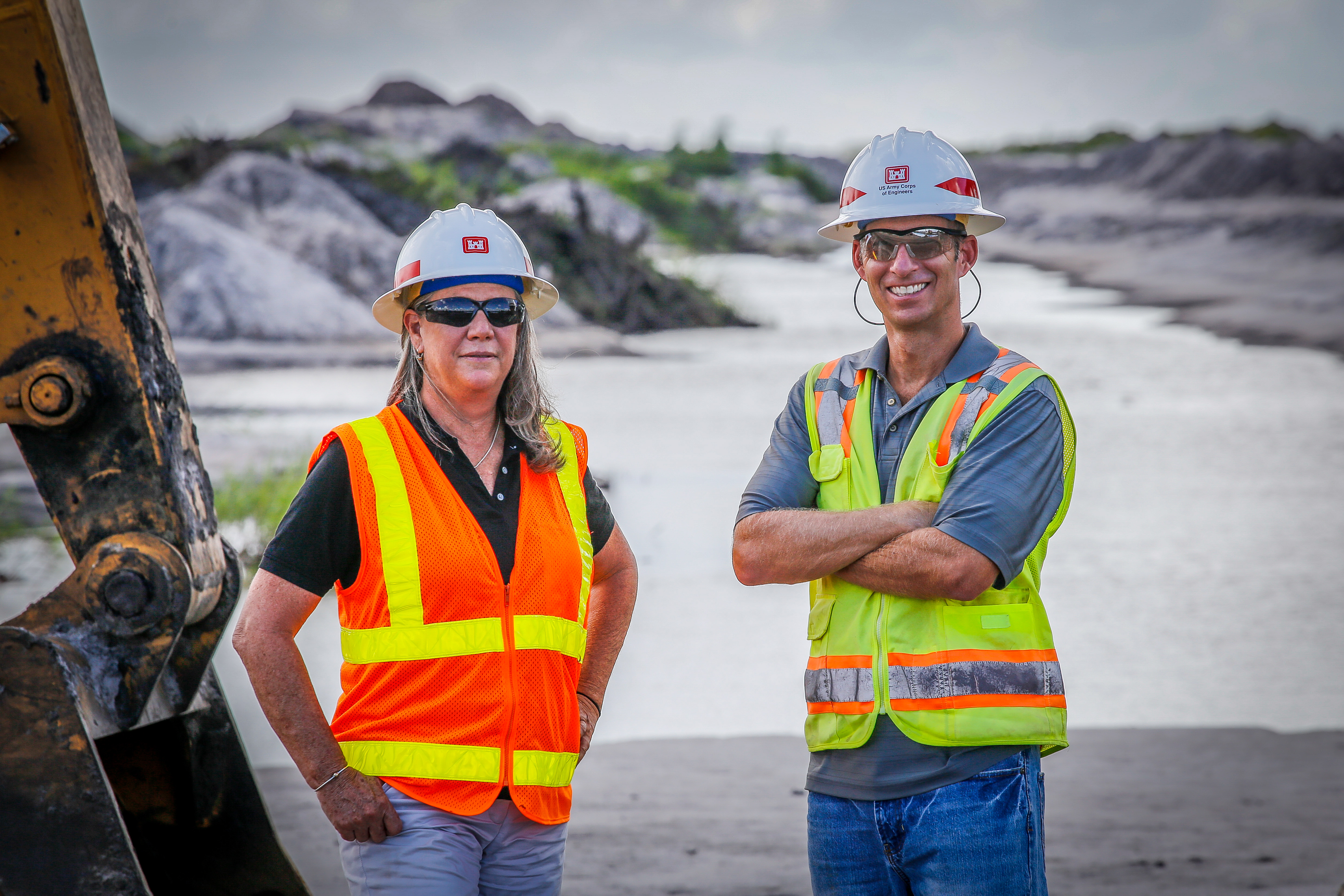
I’m a few miles east of Lake Okeechobee, stomping through a muddy construction site with a pair of Army Corps of Engineers (ACE) staffers. They’re surveying the 3,400 acres that will eventually become the Indian River Lagoon-South reservoir to store and treat water from the nearby St. Lucie Estuary, which is often polluted by agricultural runoff. We find the land soaked by seasonal rains and Irma, which had made landfall a month before, and left behind a wake of flooding and debris. Workers pump water off the property to clear the way for more construction.
The reservoir sits on land that used to be owned by Tropicana, the citrus and juice processing company, and is wedged between roads named after companies like Coca-Cola and Minute Maid, revealing the different stakeholders that have held land across south Florida. Fields of sugarcane, one of Florida’s biggest cash crops, line the road to the 741-acre site.
This project is one of many under the Comprehensive Everglades Restoration Plan (CERP), the massive, $10.5 billion initiative authorized in 2000 by the federal government, and launched a decade later. This reservoir is one more spot where water can be held and treated, directed to land when necessary, and stored during storm seasons to prevent flooding.
“The goal is, overall, to get the water right,” Kimberley Taplin, program manager of ACE’s Ecosystem Restoration Branch, tells me. “How do we get it more natural, to the extent we can?”
With 68 components, the plan is multifaceted: slowing down the flow of the Kissimmee River in the north, storing water in reservoirs around the lake, shooting water from the lake toward the east and west, and building bridges to allow the Everglades to flow under them and thrive in the south. It will take more than 35 years to complete.
CERP has become an accepted, and usually welcome, part of the dialogue around Florida’s water issues. But other parts of the legislation are more contentious. The latest debate, for example, has been over a Senate bill dubbed SB 10, a proposal approved by Florida Governor Rick Scott back in May.
This proposed law calls for a new reservoir below Lake Okeechobee, which would be able to contain overflow and store water that would be used for agriculture, to replenish the ecosystem during low tides, and drinking water in aquifers. But SB 10 also has asked for a lot of land. In the original proposal, drafted by Florida Senator Joe Negron, the state was to spend $2.4 billion to buy 60,000 acres of privately held farmland to build the reservoir.
Farmers across the state balked at this idea, particularly those in the sugar industry, one of the more powerful agricultural lobbies in the state. Dozens of companies, like heavyweights Florida Crystals Corporation and US Sugar, wrote letters or protested Negron’s bill, citing loss of jobs and land, and hired lobbyists to oppose the deal. The bill was stalled for months.
Some environmentalists, in turn, complained that the sugar industry’s political might was getting in the way of a necessary project. “We’ve been doing this and watching this for years,” Kimberly Mitchell, president of the Everglades Trust environmental advocacy group, told the Miami New Times. “Sugar could have pushed the deadline to start back. To give you an idea of how long this had been delayed already, this was the number two priority authorized in the year 2000.”
Eventually, Negron was able to push the legislation through by paring the law down in both cost and size—cutting the budget in half, and promising to use already public land being leased to farmers, instead of asking for private land. Now it is awaiting federal approval.
THE LAND
It’s easy to delineate the battle for water in south Florida—to look at Big Sugar as the corporate lobbyists fighting environmentalists for every last penny. The sugar industry has, indeed, given millions of dollars to politicians in the state, and was documented as a major source of pollution in the Everglades.
But J.P. Sasser, a former mayor of Pahokee, a 6,000-person city in the Glades, told me everyone, especially environmentalists, are getting it wrong. “They want us to be portrayed as a giant plantation, where sugar is the overseer, and everyone else is just working for them,” he said.
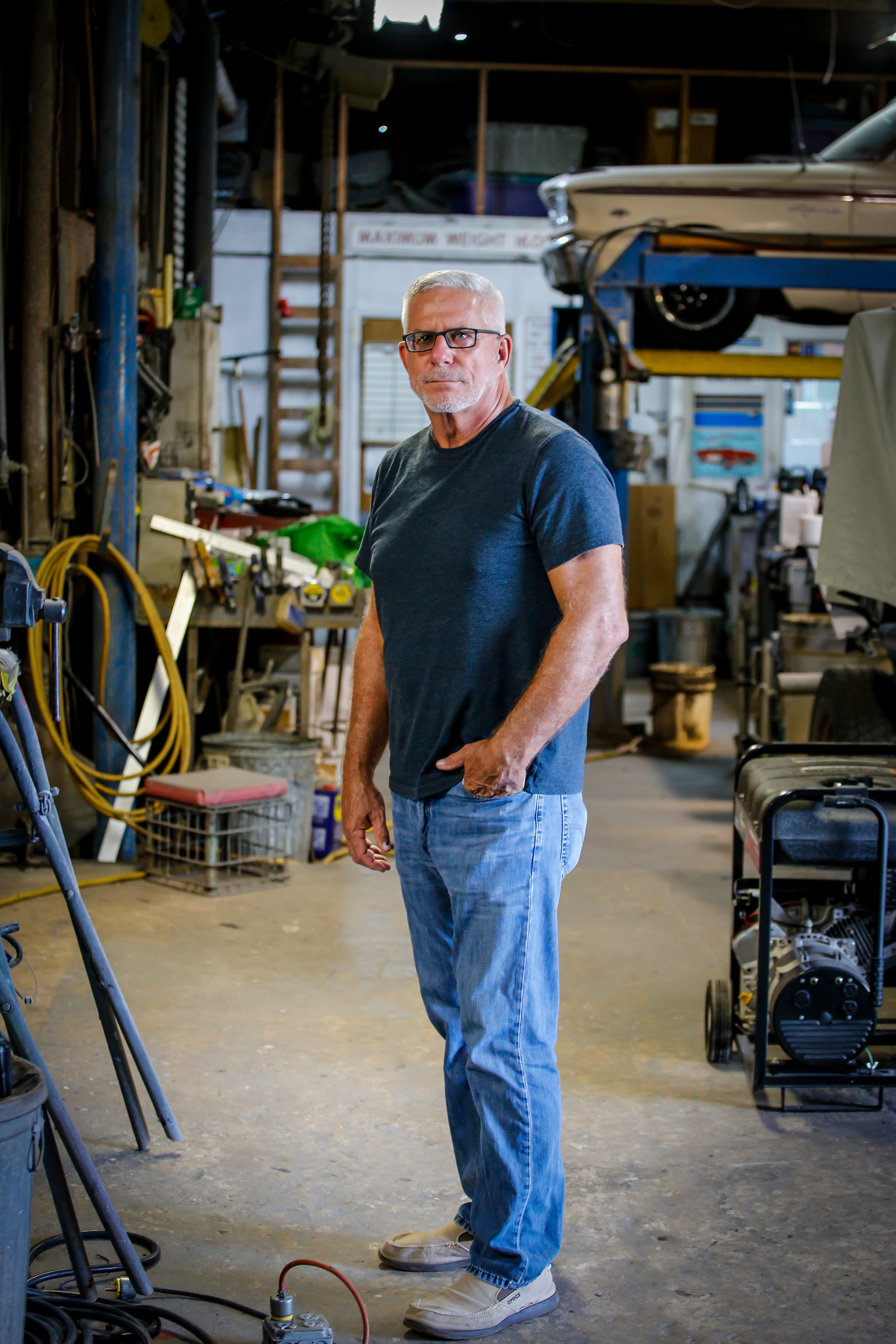
At Cavinee’s Paint & Body Shop, where he works, Sasser held court at his desk in the front office, surrounded by photos and old car paraphernalia. He was fired up about SB 10—just the night before, he had gone to a meeting with ACE officials and grilled them on the timeline for the reservoir project. He doubts that it will be funded by the federal government, or that it will be done on time.
The people of Pahokee, a city built around sugar fields, rice paddies, and mills, have seen plenty of change in the last decades. The government, without warning, Sasser said, shut down a jail in 2011 that employed hundreds of people here. In the past decade, farmers have sold off their land and moved to coastal cities looking for work.
Sasser drove me to one of the sugar mills, this one run by the Sugarcane Growers Cooperative of Florida, an organization of 45 small and medium-sized farms. The mill, which would have been sold off in the original SB 10 plan, smelled both burnt and sweet, and spewing smokestacks where sugarcane is processed. Behind the mill were some new warehouses, where an initiative to turn bagasse, the pulpy sugar refuse left over from sugarcane, into paper is now underway.
“It’s not a line etched in stone”
Despite the economic uncertainty here, Pahokee has still managed to grow in many ways, adding chain restaurants and new hospitals and a college in recent years. Agriculture, including sugar, still keeps many of the families here alive—from Sasser’s nephew to Tammy Moore-Jackson’s husband, everyone knows someone employed by sugar farms or mills, if they themselves aren’t.
“Our community has given up more than 100,000 acres of farmland,” Moore-Jackson told me. “No one in the Glades was against a southern reservoir. But we were against purchasing additional land.”
To lose more land to the government could be something like a death sentence for the Glades too, not just the sugar industry. But to lose this land to either flooding or drought would be equally damaging, potentially catastrophic, for the communities here. A spokesperson for the Sugarcane Growers co-op told me that their main concern was not SB 10, but the high levels of water flowing into Lake Okeechobee.
Meanwhile, as the government attempts to gather more land from farmers for bills like SB 10, housing developments are cropping up alongside the Everglades, threatening the swamp and any space that water has to flow alongside of it.
Most people in south Florida are familiar with what’s known as the “urban development boundary,” essentially a line that defines how close housing and development can be built to the Everglades and other natural resources. But for years, real estate developers have been testing this boundary.
Back in 1991, an archival news article ponders whether the suburb of Weston, north of Miami, should have been built on drained Everglades land. In 2013, Miami-Dade commissioners moved the line to allow for more warehouses and housing. And as recently as this year, a task force was appointed to consider moving the boundary again.
“It’s not a line etched in stone,” said Dawn Shirreffs, a senior policy advisor at the Everglades Foundation, a nonprofit environmental group. “Every couple of years we see applications from different interests. But from my understanding, the Miami Dade County Commission has been steady.”
THE SWAMP
Then there are the people who have lived among the Everglades before these land grabs began.
I met Randee Solis, a 21-year-old airboat driver, on Miccosukee Reservation land, where he’s spent most of his life and summers with his grandfather in the murky swamp waters.
The four reservation areas—about 50 miles south of Lake Okeechobee—are built on and around the Everglades, and the Miccosukee tribe, once part of the Seminole Indians, settled here in the early twentieth century. Now the four reservation areas are home to a cluster of museums and tribal administration offices that uphold tradition and laws.
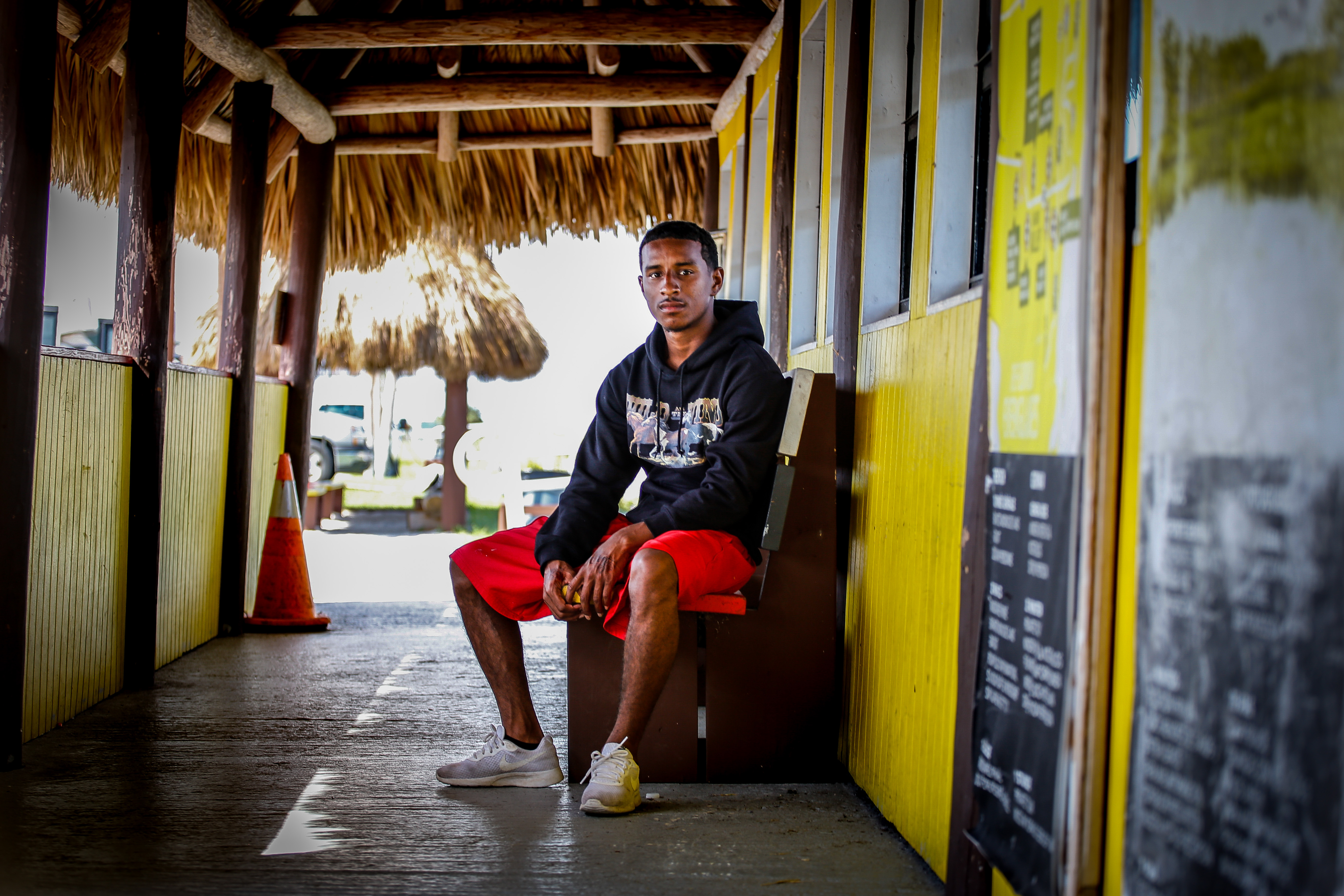
Solis said many of his family members work here, some as airboat operators, to take tourists through the Everglades. He has been doing boat tours since he was nine years old—state laws don’t apply on reservations—and knows the ebb and flow and sludge of the waterways.
He also knows when something is off. He said the runoff from agriculture industries, including sugar, has impacted area wildlife. And he’s been noticing that the water in the dry season is so low that the boats can’t make their way through the swamp.
“You don’t see a lot of the bird life, the fish are starting to disappear,” Solis said, citing the lower levels of water. “Plant life is another thing. Little by little it’s been starting to slowly decrease.”

The Miccosukees, with a population of about 550, depend on a healthy water flow to sustain their economy—a large part of which is made up of tourist attractions like airboat rides, casinos, and food stalls serving alligator bites. But the tribe’s location has made it particularly vulnerable to any changes in water management regulations. In 2003, the tribe teamed up with environmental group Friends of the Everglades to sue the South Florida Water Management District for pumping polluted water into their conservation area.
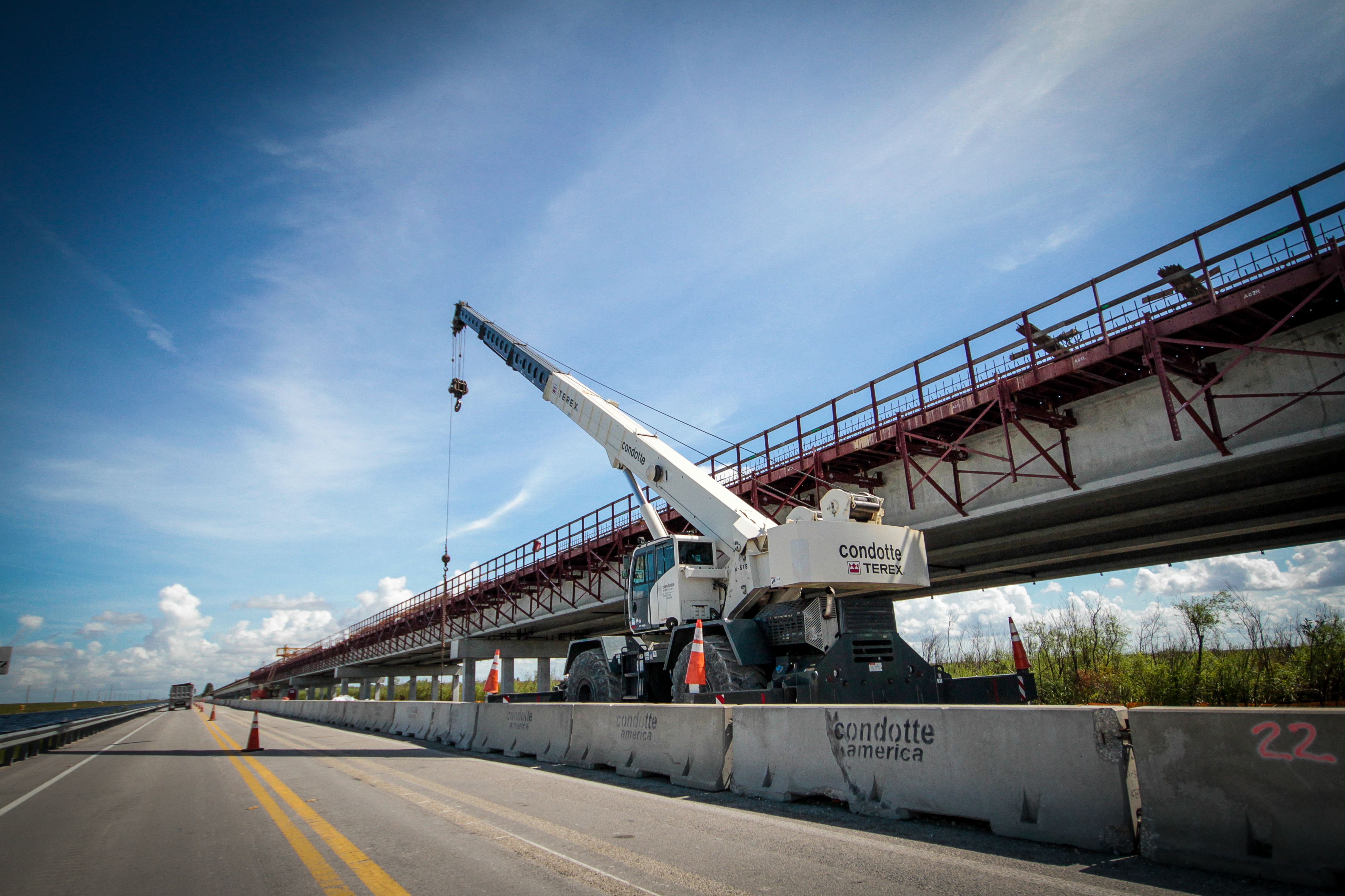
Then in 2010, the tribe sued ACE over a plan to build a bridge along the Tamiami Trail, a road that cuts through the Everglades in south Florida. This plan, part of the Everglades restoration project, was engineered to allow water and wildlife to flow underneath the road, instead of getting cleaved by the asphalt. But the plan would also inevitably flood and claim some of the reservation land.
The Miccosukee lost this case—the court ruled that the plan didn’t violate the Everglades National Park Protection and Expansion Act, which protects the size of the park. During a recent visit, the construction on the Tamiami Trail was underway.
“That’s to remove the barriers to flow,” said Taplin, the Army Corps program manager, who grew up close to the park. “As you know we starved water to the Everglades National Park, so how much can we restore flowing south?”
THE WATER
Down here in the Glades, the lake can give life or take it away. Nobody can escape some level of understanding of the water and how it’s being managed. Everybody has a story about flooding or drought. Everybody knows about some part of the bills and legislation.
Amid a yard of yachts and speedboats, Jim Dragseth sat at a desk, surrounded by photos and maps of the St. Lucie River and its nearby creeks. The president of Whiticar Boat Works, a yacht dealer and repair company that his family started, Dragseth has kept a close watch on the water quality around him in Stuart, Florida. He’s someone who keeps the University of Florida Water Report, a comprehensive report of the water conditions that holds an almost Bible-like status in these parts, in his bookshelf.
“I’m not a big fan of the senator’s lake plan,” he said of Negron’s SB 10, though he applauded the effort to use public land. “Personally, I’m disappointed they haven’t been able to slow the flow into the lake.”
The St. Lucie River, and the nearby estuary, is usually flush with wildlife and biodiversity. In the early twentieth century it was one of the waterways connected to Lake Okeechobee by a man-made canal in an attempt to allow for barges and boats and discharge excess water from the lake when the water levels are too high. That means the lake water that originally flowed south to the Everglades now enters the river.
In more recent years, this system has proven dangerous. In 2013, 2016, and this year, ACE discharged billions of gallons of water from Lake Okeechobee into the rivers to avoid flooding. And with it, freshwater algae and bacteria that started to destroy the ecology of the St. Lucie River and Estuary.
Florida Gov. Rick Scott called a state of emergency last year, blaming the federal government. “If the Obama administration had properly budgeted the necessary funding to maintain the dike to operate at its higher potential capacity of 18 feet, the Corps would not have been required to discharge approximately 30 billion gallons of flood waters,” read Scott’s executive order.
“We’re still getting a ton of outflow out from the lake. It looks like gasoline in water.”
Dragseth said inshore boating and fisheries suffered from the increasing lake discharges. And septic tanks and agricultural runoff were polluting the waterways alongside algae and bacteria. But at his business, alongside Willoughby Creek, off the river, he said there’s another problem.
“What impacts our business more is water depth,” he said, since the creeks are getting shallower. “But it’s still pretty, still nice, still warm.”
Nearby marinas were reluctant to talk to me about the algae issue, since it had impacted their businesses in the past year—the boating and fishing industries stand to lose significant profit to pollution. And water quality reports from the Florida Oceanographic Society, a nonprofit, showed C, D, and F ratings across the board for the nearby rivers and estuaries.
Following the rivers farther across to the coast, it seems that the diverted waters from Lake Okeechobee only get messier. “We’re still getting a ton of outflow out from the lake,” said Josh Davis, a lifeguard working on Jupiter Beach on the eastern coast of the state. “It looks like gasoline in water.”
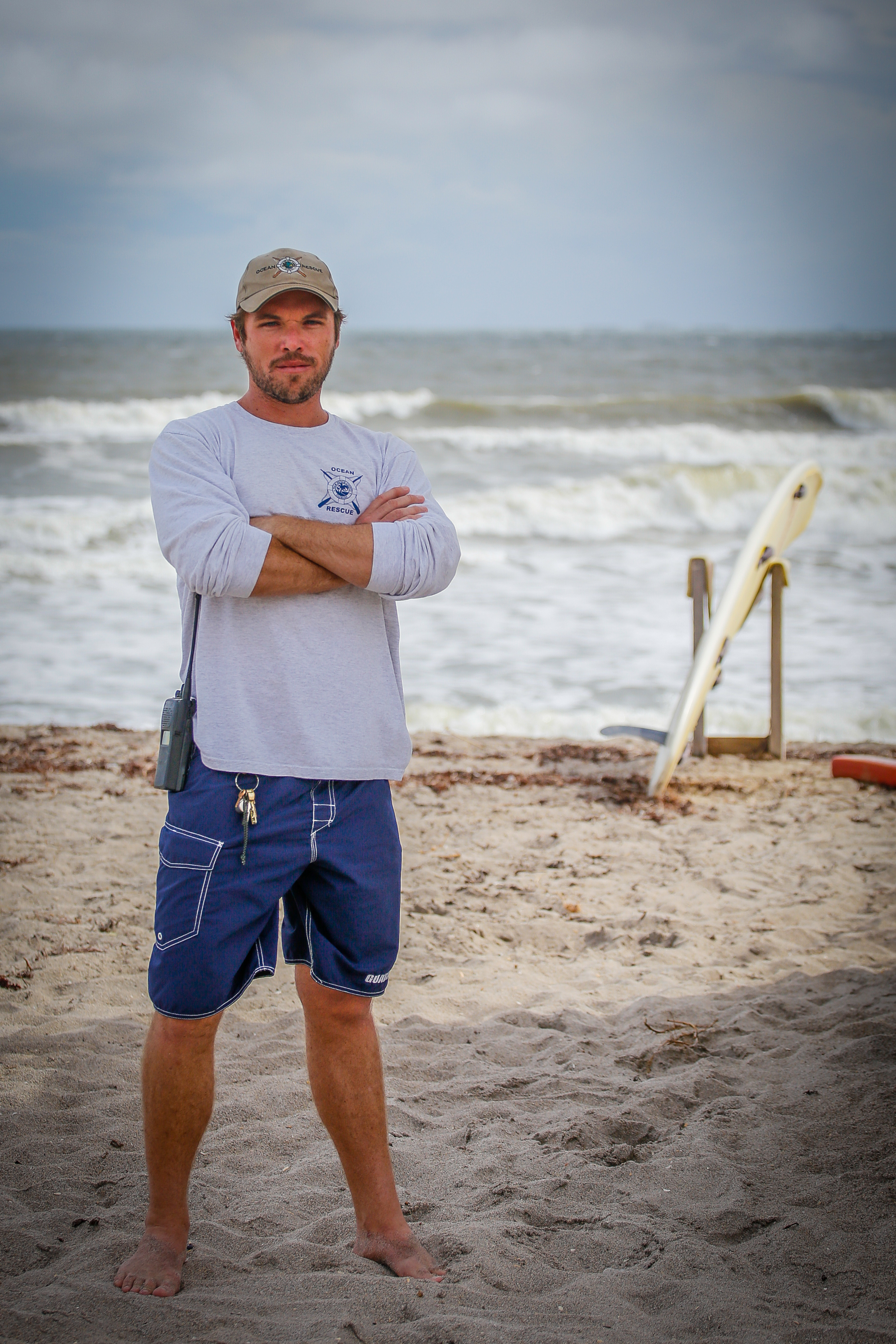
Davis, who grew up on West Palm Beach, and who has been a lifeguard for almost a decade, said he now watches the lake water discharges slowly inch across the ocean in front of him, turning blue water into brown sludge. During the week I visited, the combination of lake overflow post-Irma and the King Tides that usually come in the fall meant the beach was down to a thin strip of sand.
Both Davis and Dragseth said the Everglades Restoration Project, with its mandate to restore at least some of the natural water flow, could be beneficial to what they see everyday in their backyards. They’re just not sure at what cost, or on what timeline.
As Davis said, “I don’t see an end in sight to it.”
*
To the untrained eye, Lake Okeechobee seems calm, peaceful on this warm October afternoon. Palm trees arch over the placid face of the lake; birds and fish scuttle on the banks. You wouldn’t know that the dike’s barriers are too low, that communities have to pump water back into the lake, and that the threat of bacteria and algae live here, under this glassy facade.
If the lake, and south Florida, have been an experiment in man versus nature, then it would seem that both have lost. The water haunts the people who live near it, or downstream. The government is pumping billions of dollars to restore a waterflow it once tried to divert. Meanwhile, the Everglades struggles to rebound from both shallow, dry seasons, and from flooding, depending on the time of year.
Tammy Jackson-Moore, sitting on a dock on top of the lake, spends her days thinking about the Herbert Hoover Dike. She publishes the water levels of the dike on the Guardians of the Glades Facebook page—letting people know when the levels get close to flooding. If the Everglades restoration project manages to undo the past, then there’s a chance her community and others like it can continue coexisting with the water in the future. If the government stalls though, the levees are still a storm away from giving away.
“We’ve had people contact us saying when is the time for us to leave our community, when is that trigger point that we need to be packing up and leaving,” she said. “That is an incredible amount of stress.”
All GIFs by Lia Kantrowitz. Caroline Haskins contributed research. Editing by Brian Anderson.
Get six of our favorite Motherboard stories every day by signing up for our newsletter.