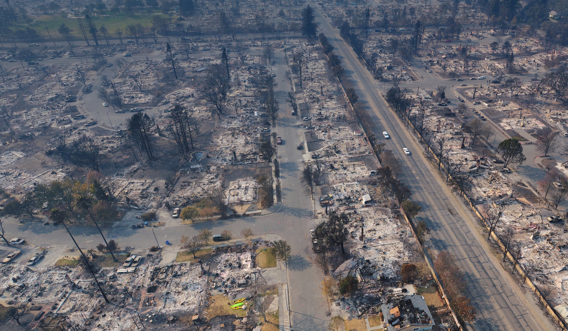
These 360° Drone Maps of California’s Wildfire Damage Are Horrifying
Credit to Author: Samantha Cole| Date: Fri, 20 Oct 2017 00:47:17 +0000
The damage is devastating. In high definition, it’s horrific. Every charred brick in a hearth attached to nothing, every burned detail in a metal chair that sits still-propped against a partially collapsed wall. You’re hovering over what used to be someone’s living room, and it’s crystal-clear down to the half-inch.
This is the most detailed, highest-resolution drone mapping of damage caused by the northern California wildfires. Greg Crutsinger captured about 350 acres of the nearly 53,000 acres of homes and land consumed by the flames.

These 360-degree shots (which are not embeddable) are harrowing and upsetting.
Alameda County Sheriff’s department called on Crutsinger to volunteer his drone business to help map the Coffey Park neighborhood, where 2,500 homes were burned and several people died or are missing.
The FAA issued temporary flight restrictions over the area, but with the county’s clearance, he’s able to fly at a range of altitudes and map the area extremely accurately in 360 degrees—every pixel represents half an inch.
For scientists studying how wildfires spread, this data will be invaluable for understanding how wildfires rip through residential areas. Gas and electric companies can use the data to understand how to rebuild. Evacuated residents can get a glimpse of what they’ll return to once they’re allowed to go back to where their homes once stood.
Crutsinger told me he took 10,000 photos overall, and it took two days to process a rough stitch of the map. For a less data-heavy, but still valuable, view of the scene, he used the Hangar 360 app: The drone flies straight up, takes photos with the camera straight up, at 45 degrees, and straight down, and then sends the images to the cloud.
It’s processed and ready in minutes, instead of days—and the panoramas are sharable with links that can be passed around to firefighters or rescue crews to coordinate efforts. They also provide a look at the damage done, while it’s still untouched by people returning to sift through what’s left.