Louisiana’s Plan to Punch a Hole in the Mississippi River
Credit to Author: Rosemary Westwood| Date: Tue, 29 Aug 2017 14:00:00 +0000
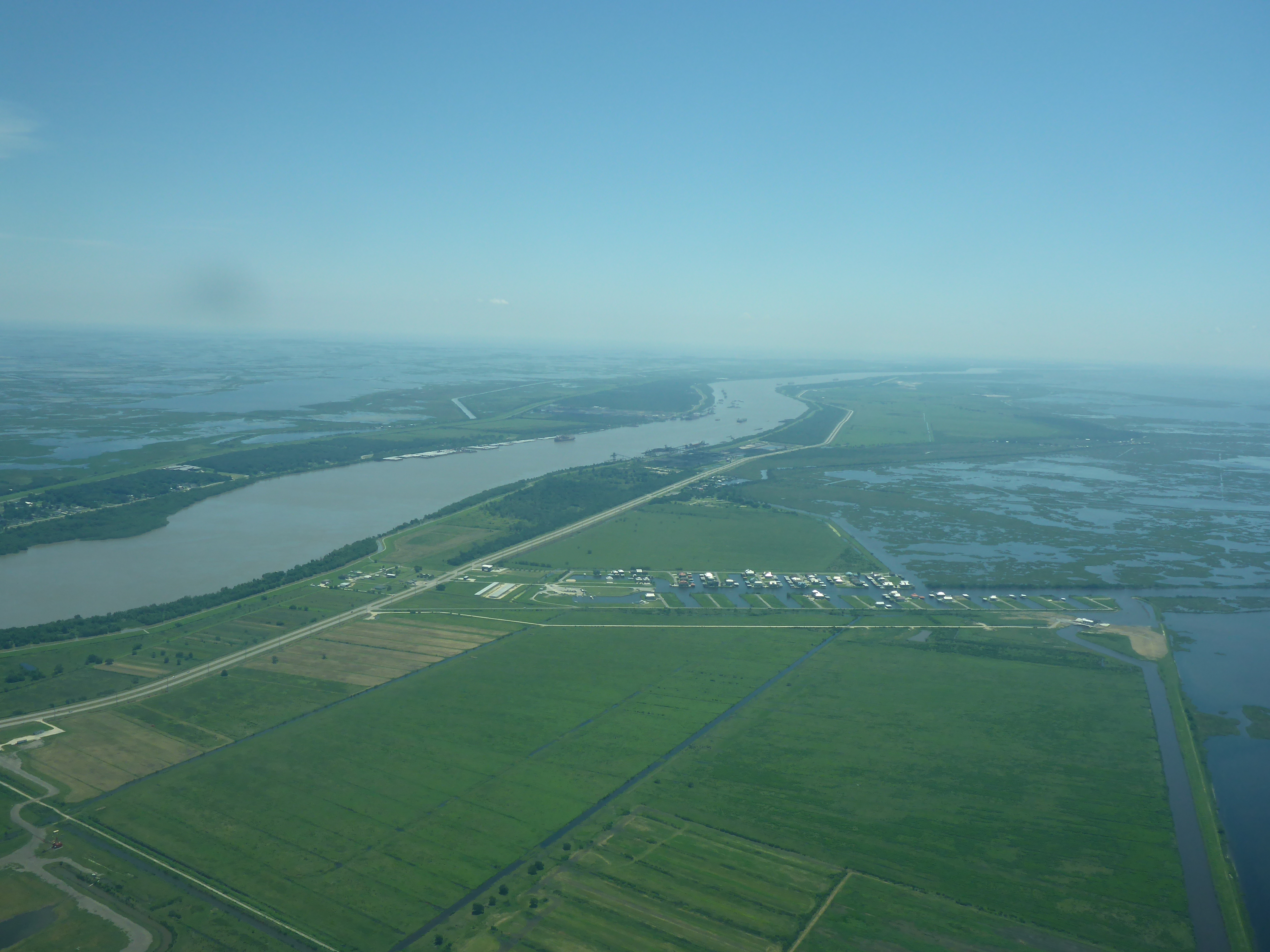
The Mississippi River—a trudging, steady flow of ruddy water, sand, and mud—snakes across southern Louisiana, bisecting New Orleans and a large swath of fast-disappearing emerald swampland.
Where the river exits into the Gulf of Mexico in Plaquemines Parish, the land has been reduced to a narrow spit, improbably jutting into the open water like a knife balanced off the edge of a table.
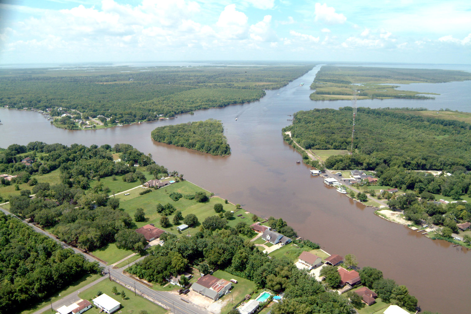
Louisiana has new plans for the tail end of the Mississippi. After decades of building levees along its banks, the state now hopes to cut a hole in the river’s edge and siphon off a large flow of sediment and water into the nearby Barataria Basin, south of New Orleans. This would help rebuild the coastline in an area with one of the highest rates of land loss in the world.

Between 1932 and 2010, Louisiana lost more than 1,800 square miles of coastland to a myriad of factors, including sea level rise, subsidence (land settling or sinking), and oil industry development. If wetland loss were to happen at a constant rate, it would amount to about a football field every hour, according to a 2011 estimate. Though it’s slowed since then, the latest study from the US Geological Survey, published in July, found the rate is now a football field every 100 minutes.
The $1.3 billion Mid-Barataria diversion project is the largest of the sediment diversions outlined in the Louisiana’s $50 billion 2017 Coastal Master Plan, unanimously passed by state lawmakers in June and widely supported by environmentalists, scientists, and restoration groups across the state. But fishermen and communities in the crosshairs worry that the project could upend a lifestyle going back generations.
*
Neither the state nor Army Corps of Engineers have attempted to suck sediment from the river before.
The master plan calls for 124 separate projects over 50 years, which together are expected to maintain or build 800 square miles of land, saving the state a total of $8.3 billion in economic damage that might otherwise inflict the people, industries and communities along the coast.
The Mid-Barataria diversion is still at least five years away from breaking ground, as construction waits for extensive environmental reviews required by the National Environmental Policy Act.
Yet it’s an process as old as the river itself—which, long before the levees, regularly deposited water and silt into the nearby land when the banks flooded. Some were dreaming of this project at least as far back as 1989, when the newly formed non-profit Coalition to Protect Coastal Louisiana first begged the state’s lawmakers to “think boldly” to combat the already alarming rate of coastal land loss with one major, cornerstone request: Divert water and sediment from the Mississippi into the surrounding marshland.

“The state and the nation will either act now to save Louisiana’s four million acres of coastal wetlands—forty per cent of the nation’s coastal marshes—or lose them forever,” the coalition warned in its starkly titled report: Coastal Louisiana, Here Today and Gone Tomorrow?
Nearly three decades later, thanks to the full backing of the state’s politicians, Louisiana is poised to take on the task.
“All the organizations that we work with believe that the master plan is an absolute godsend, and it’s a blueprint to do the work that needs to be done,” said Jimmy Frederick, the coalition’s communication director. As lawmakers approved the plan, Kimberly Davis Reyher, the executive director, said the mid-Barataria diversion “may very well be the most important environmental construction project in the history of our country.”
“They’re going to hit us in the heart. They’re deserting us”
It comes as research shows that in addition to faster rising sea levels, the land is sinking more quickly than expected. In June, scientists published the most intricate map to date of the rate of subsidence across the coastline, finding that while previous estimates suggested a rate of 6 mm per year, it’s actually an average of 9 mm.
“That doesn’t sound like very much, but you have to compare it against the fact that Louisiana is really low,” said Jaap Nienhuis, the study’s lead author and a researcher at Tulane University. “So if it’s only half a meter above sea level, than 9 mm brings you to that point in only nine year or eight years.”
Read More: Mutated Fish Still Haunt Louisiana’s Fishermen After the BP Oil Spill
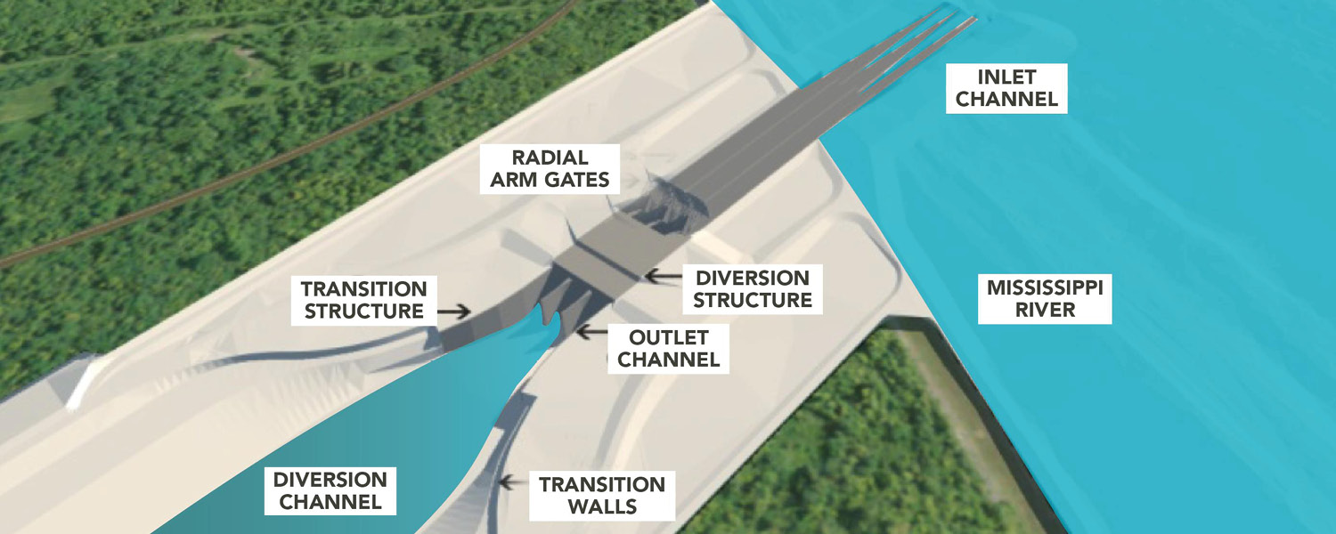
The Mid-Barataria sediment diversion will be massive: Diverting as much as 75,000 cubic feet per second of water and sediment, a flow greater than the 50,000 cubic feet of the Niagara Falls in its off season.
According to current plans (much of the engineer work remains to be done), the steel and concrete structure will spread roughly 1,600 feet wide, 25 to 40 feet deep, and run about 2 miles in length, cutting across land on the Mississippi’s southern banks. Gates would rotate open and closed to control the water and sediment, which would be funneled through a channel and into the Barataria Basin.
Or, as it’s know to Acy Cooper, the stretch of coastline where he’s made his living since he bought his first boat at the age of 14.
“They’re going to hit us in the heart,” said Cooper, a shrimper and president of the Louisiana Shrimp Association, and lifelong resident. He argues the sediment and fresh water will destroy oyster beds in the area and push warm, salt-water-loving shrimp further out to sea or stunt their growth. Something must be done to save the disintegrating coastline, he said, but he thinks the state has other options. By pushing forward with the Barataria project, he said, “they’re deserting us.”

Cooper also worries about what will come flooding into the basin, along with mud and water. This year, the dead zone in the Gulf of Mexico spread to the largest on record, roughly the size of New Jersey. It’s a biologically anemic area caused by fertilizer runoff carried downstream from across the US by the Mississippi River, which leads to reduced levels of oxygen in the water and a dearth of all kinds sea life.
“The same water that’s killing the water in the gulf will be in our estuary,” Cooper warned.
The question of how to help fishermen like Cooper is only now being taken up in earnest, said Frederick of the Coalition to Restore Coastal Louisiana, something his organization is hoping to help spearhead.
And there may be ways to ease the impact. Research published this summer argues fish and oyster stocks can be protected by gradually increasing the flow of water and sediment, and restricting it to the winter months, when the river is naturally higher and oysters are better able to withstand a cold, freshwater deluge.
Timothy Kerner, the mayor of Jean Lafitte—a community on the edge of the basin and in the middle of the diversion potential impacts—said there’s no question the project will change the estuary. That’s, in fact, the whole point. And in that case, he argued, the local community and fishermen should be compensated.

“You have to have something set aside to make sure those people can still pay their bills,” he said. “If you’re going to spend that much money—if it’s that important—surely you can find enough money to compensate the negative impacts.”
And indeed, most people believe the project should be built—and built soon. “I think there’s an acceptance that the science underlying diversions is very robust,” said Alexander Kolker, an associate professor at Louisiana Universities Marine Consortium and part of the 2017 Coastal Master Plan oversight team. And with Louisiana’s dire land loss, “the state needs large scale projects.”
The goal isn’t to restore what’s been lost, Frederick added, so much as save as much as possible of what coastline is left—and even then, not every part can be saved.
Get six of our favorite Motherboard stories every day by signing up for our newsletter.